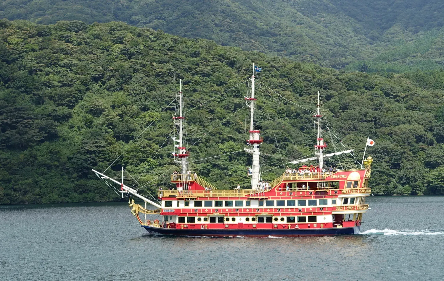
Hakone / Guide
Lake Ashi Was Made by a Falling Mountain: Cross It One Way
Lake Ashi芦ノ湖
If cloud hides Fuji when your boat leaves Tōgendai, don’t spend the crossing waiting for it; look at the shores instead — the steep caldera wall on the west, the old lava on the east — because between them sits the part of this lake I came to love most: a mountain that collapsed about 3,000 years ago, dammed a river and made the water you are crossing.
You may well be coming for one picture, Fuji over the water, and nobody here promises it. Kanagawa Prefecture lists Onshi-Hakone Park, on the southern shore, among the Kantō region’s 100 views of Fuji, yet even the park’s own lookout at Benten-no-hana is described as a Fuji view for a clear day. You may as well know, then, what else is out there, and the answer turns out to be the lake itself.
A lake younger than it looks
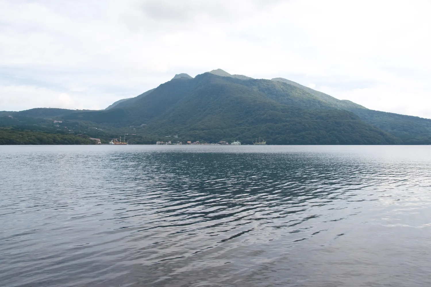
The Hakone Geopark tells the lake’s beginning in one plain sentence. About 3,000 years ago Kamiyama, one of the younger peaks inside the old Hakone volcano, erupted and collapsed; the debris slid into a large lake that already sat in the caldera and, at the same moment, blocked the Hayakawa River. You are floating, in other words, on the water that backed up behind that blockage.
That is why its two sides do not match. On the west, the geopark notes, the shore is the steep inner wall of the caldera’s outer rim. Look east, and the shore is lava from the younger mountains, Kamiyama and Komagatake among them. Picture the boat pulling away from Tōgendai with the wall on one side and the lava on the other, the old volcano and the young mountains facing each other across the deck.
Don’t expect a vast lake from so violent a start: the surface sits about 720 meters above sea level, it covers 6.9 square kilometers, and it is 43.5 meters at the deepest point. My favorite detail is one you can no longer see. Dead cedars once stood up out of the water, and because their reflections hung upside down on the surface, people called them the “upside-down cedars”.
Even a fish carries the place in its name. The Japanese dace is called Tribolodon hakonensis, the geopark explains, because the specimen it was named from came from Lake Ashi.
Take the pirate ship one way
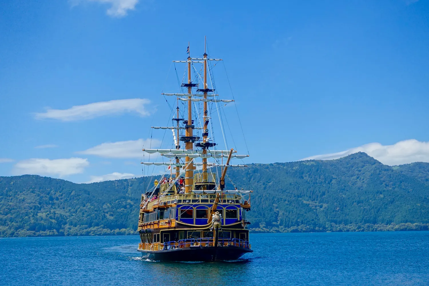
The Hakone Sightseeing Cruise, the “pirate ships”, links three ports: Tōgendai at the north end, and Moto-Hakone and Hakone-machi at the south. If you come over the mountain on the Hakone Ropeway from Owakudani, Tōgendai is where it ends, and where the boats leave.
Buy a one-way ticket rather than a round trip, and let the boat carry you south instead of sailing back the way you came. A one-way ticket from Tōgendai to either southern port is 1,700 yen for adults (850 yen for children); a round trip is 3,000 yen. There is one catch I would not want to discover on the pier: with a one-way ticket, you cannot get off at a port in between. If you hold the Hakone Freepass, the boats are included and you can get on and off as you like.
Which southern port you pick decides your afternoon:
- Hakone-machi: the old checkpoint, Hakone Sekisho, is a 5-minute walk away.
- Moto-Hakone: step off and walk the cedar road toward Onshi-Hakone Park and on to the checkpoint.
If you have the afternoon, I would get off at Moto-Hakone. The boat company also warns that thick fog or strong wind can change a boat’s destination or cancel it, so if the weather is turning, check before you plan the walk around a particular port.
The water does not go where you would expect
The lake began as the headwater of the Hayakawa River, which is what made the next line in the geopark’s account such a surprise to me: today a sluice gate at Kojiri controls that outlet, and except at times such as heavy rain, no lake water flows into the Hayakawa at all. It leaves west instead, into Shizuoka, through a tunnel cut by hand through the mountain rim.
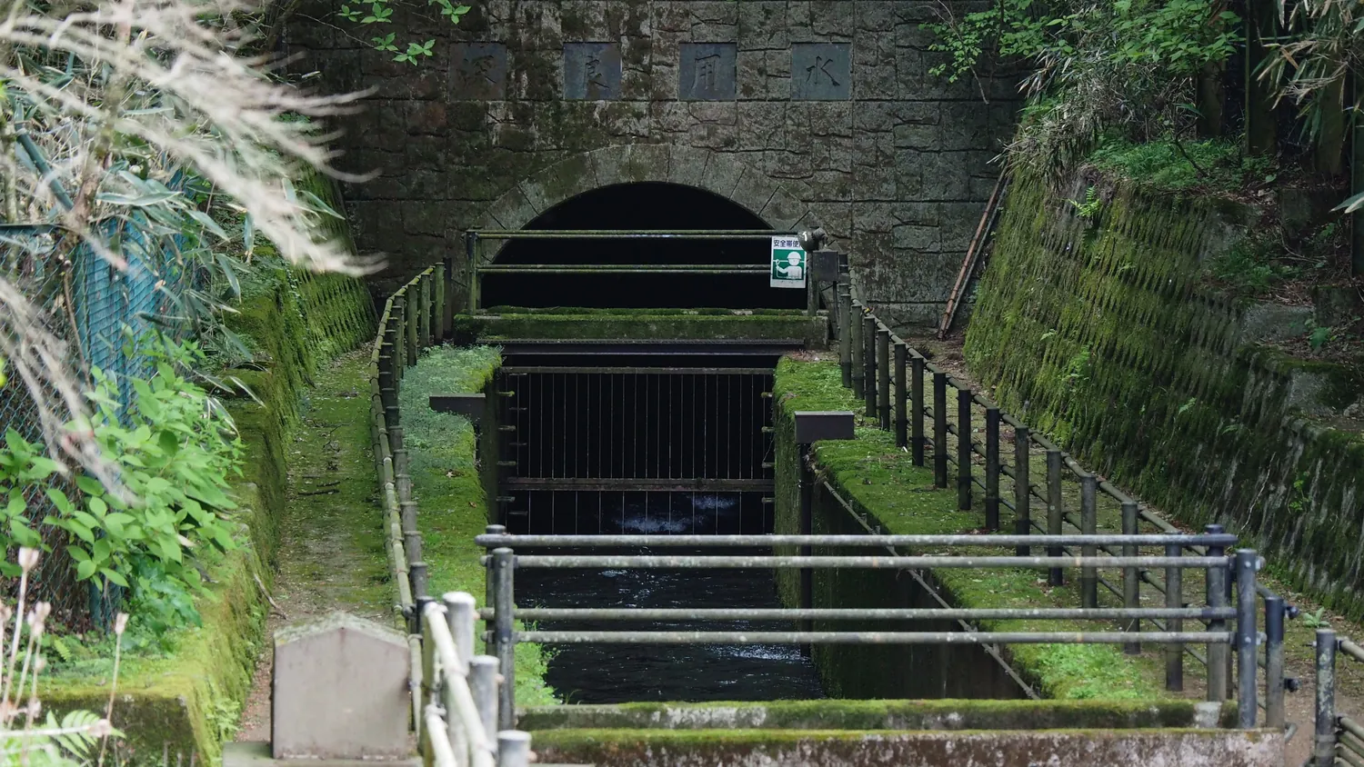
The city of Susono, where the water comes out, tells the story in detail. Its villagers struggled to keep water on land where the rain sank straight into the ground, so in the 1660s their headman, Ōba Gennojō, planned to bring Lake Ashi’s water through the rim, with the help of an Edo merchant, Tomono Yoemon. Digging began in 1666 from the Shizuoka side and, three months later, from the lake. They worked with chisels, and where the rock was too hard they poured oil on it, set it alight and threw water on the hot stone to crack it; one story, the city says, has them hanging lanterns every meter or two to keep the line straight. It took three and a half years and a workforce the city counts at 840,000 in total, and when the two ends met, they were only about a meter apart in height.
The tunnel is 1,280 meters long and closed to the public. What stays with me is that it is still working: since 1670 it has carried the lake’s water to Shizuoka’s farms, and today, the city adds, it turns hydroelectric turbines too.
The rain has a hidden route of its own. The Hot Springs Research Institute of Kanagawa Prefecture estimates that only about a quarter of the rain on the surrounding slopes reaches the lake within about three months, and that some 33 million tons a year, about 45% of it, soaks deep into the ground. That water, the institute believes, is a main supply of Hakone’s hot springs, so the lake and Hakone’s baths, in the institute’s view, draw on the same rain.
The walk under the cedars
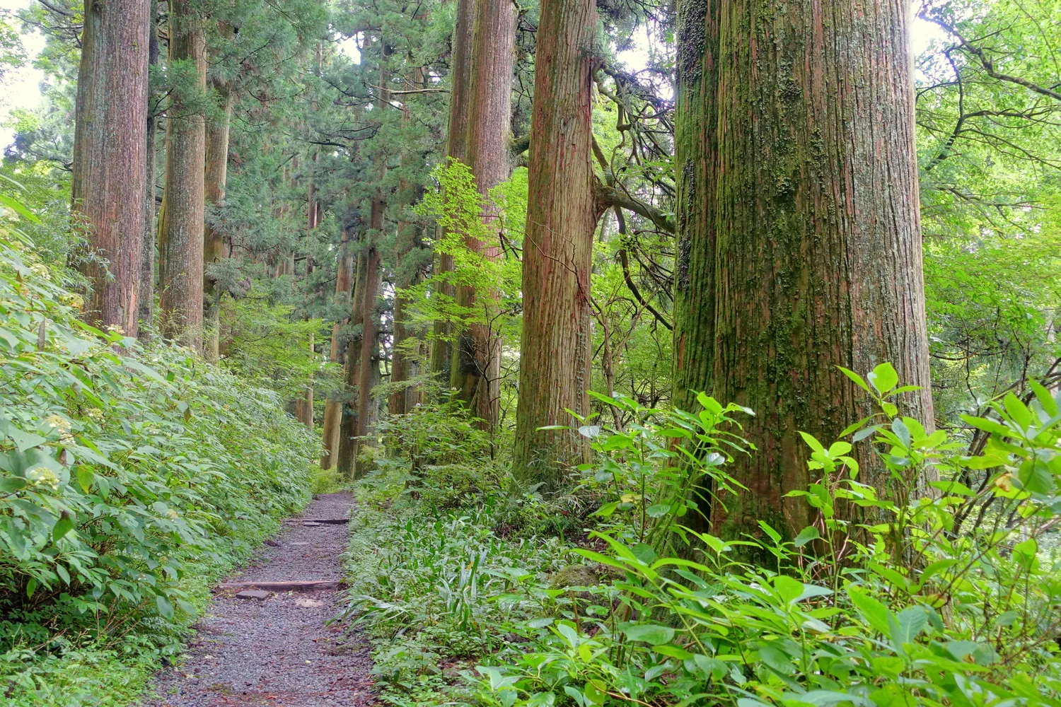
From Moto-Hakone to Onshi-Hakone Park, the old Tōkaidō road runs under about 500 meters of cedars. The town’s tourist association passes on the tradition that they were planted in 1618 on the shogunate’s orders, and says some trunks are 4 meters around. Picture the shade closing over the old road, and the lake showing now and then between the trunks.
The line was once much longer. In 1904, the association says, more than a thousand pines and cedars along the road were cut and sold to raise money for a new road being built from Yumoto up to the lake, a trade I find hard to forgive. The trees that survived are now a national historic site.
If Fuji does come out
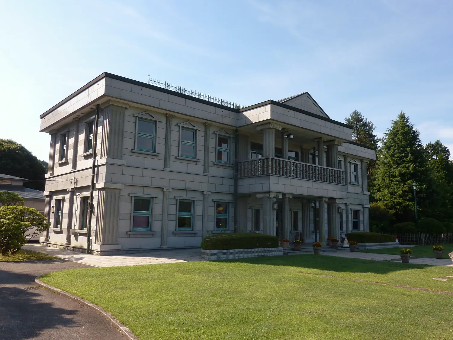
Onshi-Hakone Park stands on the site of the former Hakone Detached Palace, and you pay nothing to enter. Climb to the balcony of its Lakeside Observation Building, a two-story building faced in white granite and modeled on the palace’s old Western-style building, which the park says looks out over Fuji and the lake. It is free, open 9:00 to 16:30 (an hour less on cleaning days) and closed from 29 December to 3 January; the stones of the old palace’s main building still lie in the square in front of it. On a clear day the park also points you to Benten-no-hana, the lookout on a small point over the water.
The checkpoint at the end
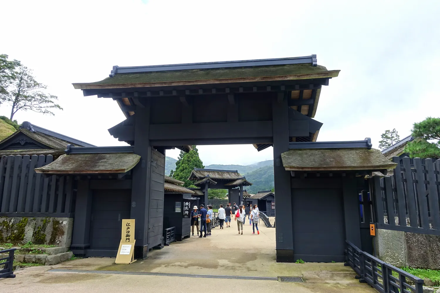
Hakone Sekisho, the Edo-period checkpoint on the Tōkaidō, is where the walk ends. It is open every day, 9:00 to 17:00 from March to November and 9:00 to 16:30 from December to February, with last entry 30 minutes before closing. Allow about 45 minutes, the checkpoint suggests; adults pay 500 yen and elementary-school children 250 yen. From there, Hakone-machi port is a 5-minute walk if you want the boat again, and the Hakone-sekisho-ato bus stop is 2 minutes away.
The other boats
If you would rather stay on the water, the pirate ships are not the only boats on the lake. The Hakone Yuransen line, a separate company, calls at Hakone-sekisho-ato, Moto-Hakone, Hakone-en and Kojiri. Its one-day ticket, 2,900 yen for adults, lets you get on and off at any of its ports, while its 40- and 70-minute loop tickets bring you back to where you boarded without letting you off on the way.
Before you go
| Pirate ship fares | One way, Tōgendai to Moto-Hakone or Hakone-machi: 1,700 yen (children 850 yen). Moto-Hakone to Hakone-machi: 600 yen (300 yen). Round trip: 3,000 yen (1,300 yen). Same-day tickets only. With a one-way ticket you cannot get off at an intermediate port. Included in the Hakone Freepass, on and off as you like |
| Weather | Thick fog or strong wind can change a boat’s destination or cancel it |
| Hakone Sekisho | Every day. March–November 9:00–17:00, December–February 9:00–16:30; last entry 30 minutes before closing. Adults 500 yen, elementary-school children 250 yen. 5 minutes on foot from Hakone-machi port; 2 minutes from the Hakone-sekisho-ato bus stop |
| Onshi-Hakone Park | Free entry. Lakeside Observation Building 9:00–16:30, free; closes an hour early on cleaning days; closed 29 December–3 January |
| Hakone Yuransen | One-day ticket 2,900 yen (children 1,450 yen), on and off at any port. 40-minute loop 2,400 yen; 70-minute loop 2,900 yen; no getting off at intermediate ports on the loops |
Checked 26 September 2026.
What I would do at Lake Ashi
I would ride the ropeway down to Tōgendai, buy a one-way ticket, and spend the crossing on the deck watching the west shore, looking for Fuji but not waiting for it.
At Moto-Hakone I would get off and walk the cedar road to the park and the checkpoint, and catch the bus at Hakone-sekisho-ato.
And if the sky cleared, I would climb to the balcony at the park, though I would not trade the walk for it.
We have not visited Lake Ashi for this guide. The facts here come from the official sources below, checked on 26 September 2026.
- Hakone Geopark — how the lake formed, its two shores, altitude, area and depth, the upside-down cedars, the dace’s scientific name and the Kojiri sluice: hakone-geopark.jp/area-guide/hakone1/007ashinoko.html
- Susono City — the Fukara irrigation tunnel, how it was dug, its length and its use today: city.susono.shizuoka.jp/kanko/2/4/2/3164.html
- Hot Springs Research Institute of Kanagawa Prefecture — how much rain reaches the lake and where the rest goes: onken.odawara.kanagawa.jp/hotspring/20200601-01.html
- Hakone Navi (Odakyu Hakone) — pirate ship fares, the one-way rule and the Hakone Freepass: hakonenavi.jp/transportation/ticket/ship/, hakonenavi.jp/transportation/ticket/freepass/; weather and cancellations: hakonenavi.jp/faq/
- Hakone Yuransen — routes and fares: hakone-yuransen.jp/route/
- Hakone Sekisho — hours, fees, viewing time and access: hakonesekisyo.jp/userguide/index.html, hakonesekisyo.jp/
- Kanagawa Prefecture and the Kanagawa Park Association — Onshi-Hakone Park, its Fuji view, the observation building and Benten-no-hana: pref.kanagawa.jp/docs/tu5/cnt/f6599/p19701.html, kanagawa-park.or.jp/onsisite/guide.html
- Hakone Tourist Association — the cedar avenue: hakone.or.jp/520
- Photographs: Kamiyama by Σ64 (CC BY 3.0); the hero image, the pirate ship, the cedar avenue and Hakone Sekisho by Daderot (CC0); the Fukara tunnel intake by Ka23 13 (CC BY-SA 4.0); the observation building by Quercus acuta (CC0) — all from Wikimedia Commons
More in Hakone
- Owakudani — For the steaming ground itself, on one of four guided walks a day
- Hakone Shrine — For the dragon shrine across the water, reached by the shrine’s boat on the 13th
- Amazake-chaya — For a walk on the Edo stone road and a cup of sugar-free amazake at a thatched teahouse
- Where to Stay — For choosing where to sleep by the water you end the day in: Gora, Sengokuhara, Lake Ashi or Miyanoshita
Explore other areas
- Hokkaido — Sapporo
- Kanto — Hakone · You are here
- Hokuriku — Kanazawa
- Koshin-Tokai — Fuji Five Lakes
- Kansai — Nara
- Chugoku — Hiroshima
- Kyushu — Fukuoka
- Okinawa — Naha
