Hiroshima / Guide
Itsukushima Shrine: Low Tide Is Not Enough to Walk to the Torii
Itsukushima Shrine嚴島神社
Pick your Miyajima day from the tide table, not the calendar.
You can walk out across the sand to the legs of the great torii only when the water drops below 100 centimetres — and in daylight that happens on only about one day in three. In December and January it is three or four days a month.
Low tide on its own is not enough. Miyajima’s tourism association says so on its own tide page: the idea that “low tide means you can walk to the torii” is, in its word, misinformation. I liked that bluntness. A tourist office telling visitors that what they have heard is wrong is what made me trust the rest of its numbers.
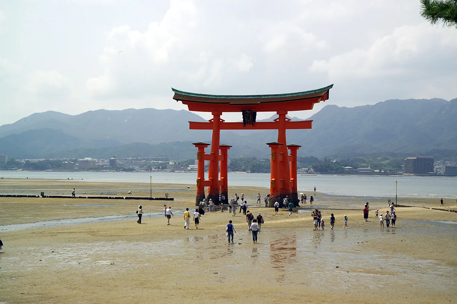
Below 100 centimetres
The great torii stands about 160 metres out from the shrine, in the sea. It is 16.6 metres tall, and the association puts its weight at about 60 tonnes.
It is not buried. Its feet simply rest on the seabed, on a bed of pine piles driven in underneath — the association’s word is “placed”. A 60-tonne gate whose main pillars are natural camphor trunks, braced by smaller legs in front and behind, and simply resting on the seabed: that is the fact I keep coming back to, and it is the reason the walk out matters. At the right tide you can put your hand on a pillar that is not sunk into the ground at all.
The number that decides whether you can is 100 centimetres. Below it, the association says, you can walk out. At 100 or above, it does not — however “low” the tide is called that day.
Picture two days. On one, the low tide bottoms out at 150 centimetres: low tide on paper, and still not a walking day. On the other it drops to 90, and you can picture wet sand running out from the shore and people walking across it.
Read the table before you book the ferry
Most days on Miyajima have two low tides and two high tides, and the association publishes all of them, month by month, with the height of the water beside each time.
You need three things to line up on one line of that table: a low tide, a figure under 100, and a time you will actually be on the island in daylight. Count through a year of the association’s tables and the three meet on about one day in three. In high summer it is around half the month. In December and January it is three or four days — and there are stretches of two weeks with no daylight walk at all.
If you are choosing between two days, I would choose the one with the lower daytime low, even if it means moving the rest of the trip around it. The shrine is open every day of the year. The walk to the torii may not come back for a fortnight.
How many days a month the sand opens up in daylight.
Summer gives you about half the month. December and January give you three or four days.
If your dates are fixed, go for high tide instead
The other famous view is the opposite one: the shrine standing over the sea, its corridors and vermilion pillars on the water instead of on sand. The association’s figure for that is above 250 centimetres.
That happens far more often. In daylight, the water passes 250 on more than four days in five. When I added that up I was relieved, because it means that if you simply time your visit to the high tide, you are very likely to get the view you came for. You may miss the walk. Check the time, and you are unlikely to miss the water.
According to the shrine’s own history, its site is said to have been chosen as a place where the sea comes in and goes out. Its visitor page asks you to mind the small gaps between the corridor floorboards, which are there to let the pressure of the sea escape at high tide. Look down at those gaps when you cross the corridor at high water, and picture the sea moving under the floor.
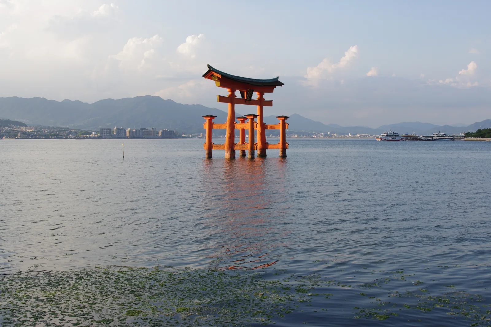
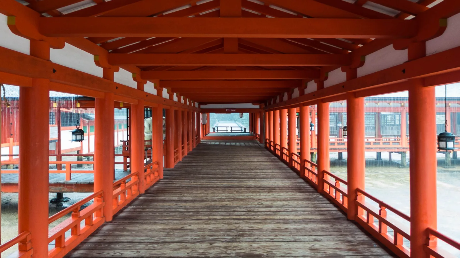
One day, both tides
On a good day you do not have to choose. On some days the table gives a morning high followed by an early-afternoon low.
If the table gives you that, walk the corridors at the high tide first, while the shrine is on the water. Eat, wait for the sea to go out, and walk to the torii in the afternoon. It is the same place twice, and it will not look like it.
If the low that day stays above 100, do not wait for it. Nothing will open up.
After dark
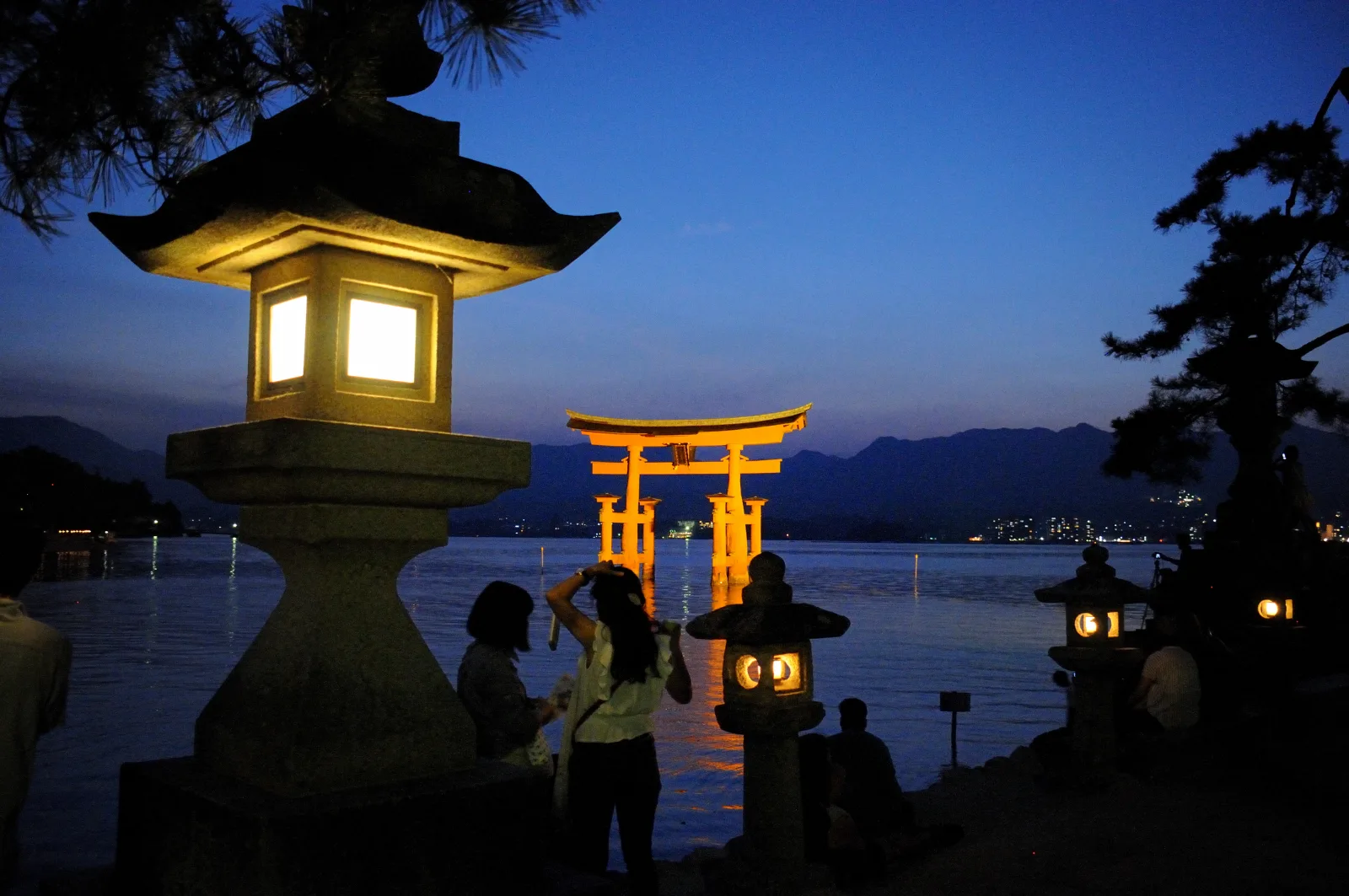
The torii and the shrine buildings are lit on most evenings from 30 minutes after sunset until 11 p.m. — the association says shrine events can stop it on some days. It is worth staying for.
But while the lights are on, you cannot go inside the shrine. The shrine closes at 5:00 to 6:30 p.m. depending on the season, so if walking the corridors is part of your plan, do it in daylight and keep the evening for looking at them from the shore.
Before you go
| Hours | open every day of the year. 6:30 a.m.–6:00 p.m. from 1 March to 14 October; 6:30 a.m.–5:30 p.m. from 15 October to 30 November; 6:30 a.m.–5:00 p.m. in December; 6:30 a.m.–5:30 p.m. from 4 January to the end of February (1–3 January differ) |
| Admission | adults 300 yen; high school students 200 yen; elementary and junior high school students 100 yen |
| Tide table | Miyajima Tourist Association, month by month (Japanese; the times and heights read without Japanese). Walk out below 100 cm; shrine over water above 250 cm |
| Ferry | about 10 minutes from Miyajimaguchi. JR Miyajima Ferry: adults 200 yen one way. Its 9:10–16:10 departures from Miyajimaguchi run close to the torii, but may not when the tide does not allow it |
| Visitor tax | 100 yen per person each time you land on the island, added to your ferry fare (preschool children and some other groups are exempt) |
| Evening | lights from 30 minutes after sunset to 11 p.m.; the shrine cannot be entered while they are on |
| Works | the east corridor is under structural reinforcement, scheduled to December 2026 |
| Deer | the tourist association asks you not to feed the island’s deer. This is different from Nara Park, where deer crackers are the one allowed exception |
Checked 23 September 2026.
What I would do with one day on Miyajima
I would open the tide table before anything else, and look for a morning with a high above 250 and an afternoon with a low under 100.
If I found one, I would take the ferry early, walk the corridors while the sea is under them, and go out to the torii in the afternoon, to the pillar that simply rests on the seabed.
If I could not find one, I would stop looking for the walk and plan the day around the high tide instead. That view is there on most days, and it is the one that belongs to a shrine placed where the sea comes and goes.
We have not visited Itsukushima Shrine for this guide. Everything here comes from the shrine, the Miyajima Tourist Association, and the ferry operator, checked on 23 September 2026.
- Itsukushima Shrine — history and the choice of site (“it is said”): itsukushimajinja.jp/jp/history.html; admission, hours and the note on the corridor floorboards: itsukushimajinja.jp/en/admission.html; works schedule: itsukushimajinja.jp/jp/construction.html
- Miyajima Tourist Association — tide tables and the 100 cm / 250 cm figures: miyajima.or.jp/sio/sio01.html (the “one day in three”, “three or four days a month”, “four days in five” and “two weeks” figures were counted from its 2026 tables, using low and high tides between 7 a.m. and 5 p.m.); the great torii: miyajima.or.jp/sightseeing/ss_ootorii.html; evening lighting: miyajima.or.jp/sightseeing/ss_lightup.html; deer: miyajima.or.jp/nature/nature_animal.html
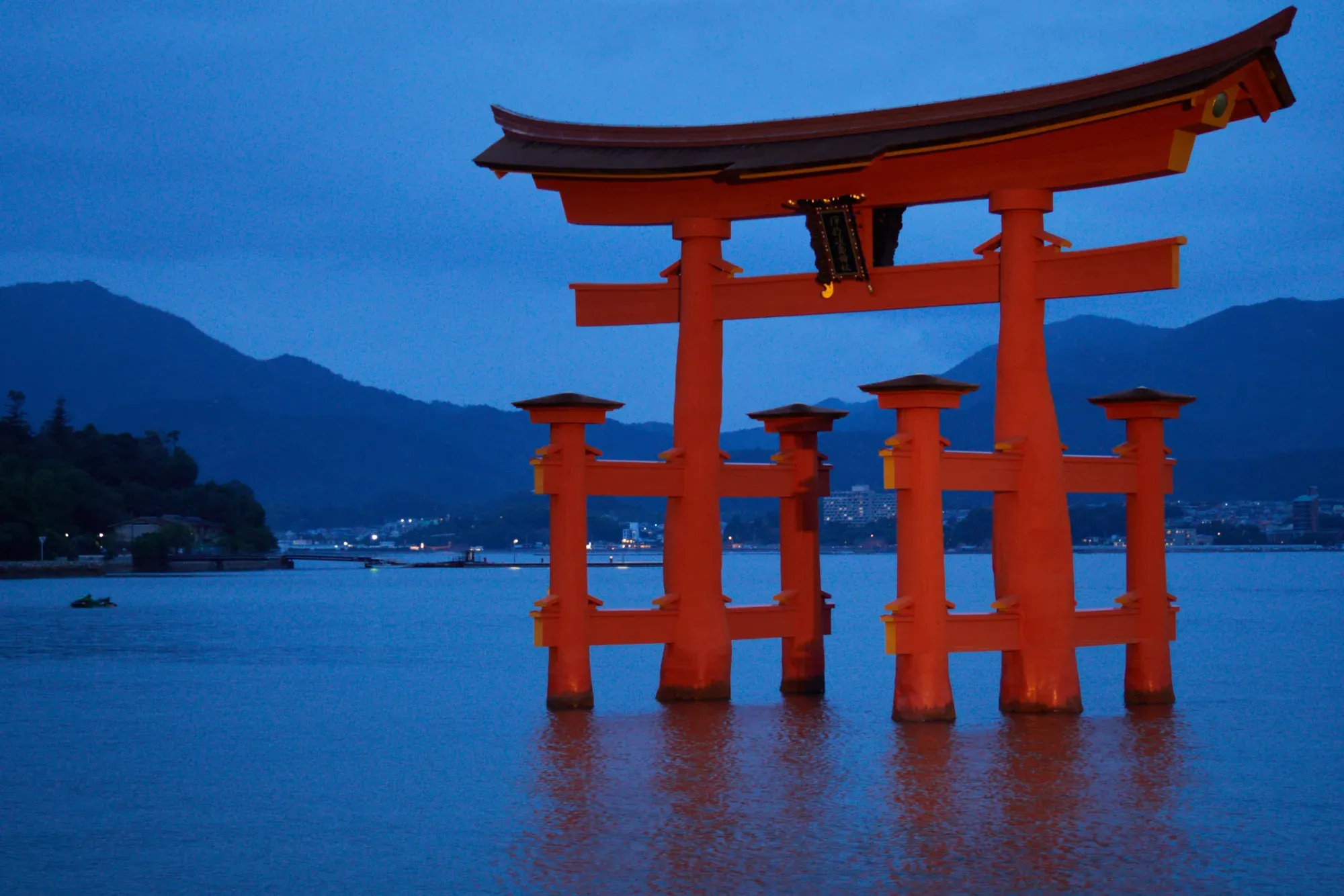
- Photographs: the hero image by lumoplank (CC0); the torii at low tide by Fg2 (public domain); the torii at high tide by Jakub Hałun (CC BY-SA 4.0); the corridor by Mustang Joe (CC0); the torii at night by Josep M. Gracia (CC BY-SA 4.0) — all from Wikimedia Commons
- JR Miyajima Ferry — journey time and torii-route departures: jr-miyajimaferry.co.jp/timetable/; fares and visitor tax: jr-miyajimaferry.co.jp/fare/
More in Hiroshima
- Peace Memorial Park — For the A-Bomb Dome, seen down the line the park was laid out on
- Hiroshima Castle — For the free, wooden Ninomaru and three trees that survived the atomic bomb
- Saijo Station Street — For brick-chimneyed breweries by day, and the station street's izakaya from five
- Where to Stay — For choosing where to sleep: Miyajima after dark and at dawn, the Peace Park, or the station
Explore other areas
- Hokkaido — Sapporo
- Kanto — Hakone
- Hokuriku — Kanazawa
- Koshin-Tokai — Fuji Five Lakes
- Kansai — Nara
- Chugoku — Hiroshima · You are here
- Kyushu — Fukuoka
- Okinawa — Naha
